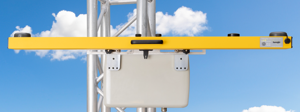
AAT Mini, AAT, and AAT Max
The Sunsight AntennAlign® Alignment Tools (AATs) are a family of precision instruments for measuring azimuth (heading/yaw), tilt (pitch), and roll planes. The products are used in telecom, defense, broadcast, satellite, and infrastructure applications for accurate installation of devices or platforms. An optional LASER rangefinder provides height-above-ground (AGL) measurements to support complete alignment validation in the field.
The AATs leverage multi-constellation, multi-frequency GNSS services, including GPS, GLONASS, Galileo, QZSS and BeiDou, as well as L1 and L2 frequency bands. The AATs use a moving baseline RTK solution that simultaneously accesses multiple satellite systems, improving accuracy, reducing time to first fix, and maintaining performance in adverse conditions. This allows the AAT to deliver reliable positioning and alignment data in environments where signal availability may be limited or obstructed.
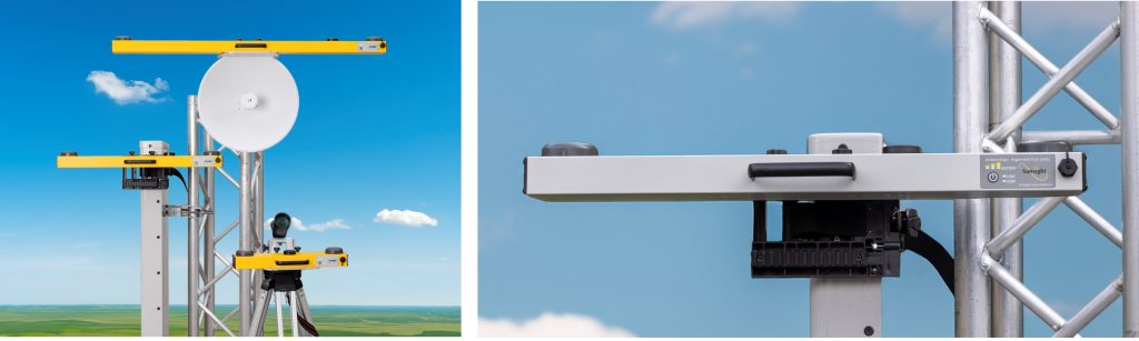
Typical AAT applications include alignment of direction (ex. cellular panel) antennas for public and private networks. The alignment technology is adaptable for use with industrial and military devices including radar and Free Space Optics (FSO).
Reliable in Challenging Environments
The AAT is designed to ensure accurate reliable alignment in real-world field conditions, including:
- Obstructed or limited sky visibility (urban environments, foliage, tower structures)
- Remote or low-infrastructure deployment sites
- High-interference or signal-degraded environments
- Complex, multi-antenna installations
Designed for Efficient Workflows
The system’s user interface, accessed via WiFi or USB-C cable, provides clear visualization of azimuth, tilt, and roll through both graphic and numeric displays. Customizable layouts allow users to optimize visibility based on lighting conditions and personal preference supporting efficient operation in bright outdoor environments.
By simplifying measurement and adjustment, the AAT reduces alignment time, minimizes rework, and supports consistent results across technicians and job sites.
Alignment Verification and Reporting
Integrated reporting capabilities allow users to capture alignment data and supporting images directly from a connected smartphone or tablet. This enables efficient documentation of installation quality and supports internal validation, customer reporting, and audit requirements.
Built for Field Durability
Designed for repeated use in demanding environments, the AAT maintains performance across varying weather conditions and job site challenges. Its durable construction supports reliable operation during transport, installation, and long-term field deployment.
What’s New in the Latest AAT
- USB-C wired control interface enables operation in high-interference environments when WiFi might be compromised
- Enhanced multi-constellation (5 systems) and multi-frequency (L1 and L2) GNSS subsystem improves azimuth acquisition under poor signal conditions
- Updated icon-based interface reduces training time and minimizes user input
- Redesigned mounting system supports a wider range of antenna shapes and sizes
Core Alignment Capabilities
- High-precision measurement of azimuth (heading/yaw), tilt (pitch), and roll (plumb) using moving base RTK GNSS
- Mean Sea Level (MSL) height measurement standard; optional AGL height via handheld LASER rangefinder
- Multi-constellation (GPS, GLONASS, Galileo, QZSS, BeiDou) and multi-frquency (L1 and L2) GNSS support for improved accuracy and reliability
- Reports in multiple global coordinate systems for international deployment, including: British National Grid, French Lambert II, Irish National Grid, and Dutch RD (Rijksdriehoekscoördinaten)
Field-Proven Advantages
- Accepted by All Major U.S. Cellular Telecom Carriers – ensures compliance with carrier requirements across all markets and eliminates approval risk
- Consistent accuracy in degraded environments – maintains performance when encountering limited sky visibility or obstructions
- Reduced equipment fragility – no built-in display or camera lens to break; minimizes possible failure points and promotes field availability
- Provides line-of-sight imagery as well as free-hand photography
- Durable construction – IP-65 rated, powder-coated aluminum housing, billet aluminum mounting system, no internal moving parts
- Supports mounting via Picatinny/MLOK rails. The housing also includes threaded inserts to support custom mounting solutions for specialized installations
- Designed for real-world use – performs reliably in tower, rooftop, and other demanding outdoor conditions
Alignment Verification & Reporting
- Generate PDF and CSV reports directly from the field
- Capture antenna line-of-sight images using the AntennaView™ Camera Mounting System
- Export Google Earth files for spatial visualization and documentation
- Create patent-pending Virtual Reality Interference Reports (VRIR) for advanced obstruction analysis
- Supports installation closeout requirements with verifiable alignment data and imagery
Lower Cost of Ownership
- No required factory calibration maximizes field availability and minimizes service costs
- End-user calibration completed in under two minutes
- Combines multiple capabilities into a single system-no need for additional tools
AntennaView™ Camera Mounting System
- Aligns smartphone camera with antenna boresight for accurate horizon and line-of-sight visualization
- Identifies potential obstructions quickly without requiring embedded camera hardware
- Eliminates fragile, high-cost, high maintenance integrated camera components
- Allows free-hand photos for installation verification required for many closeout reports
Additional Details
- Extensive reporting formats included: PDF, CSV, image capture, and Google Earth files
- 3-year manufacturer’s warranty
- Designed and manufactured in the USA by a small business
- Sunsight invented GNSS-based antenna alignment in the USA 20 years ago
Accurate. Reliable. Sunsight.
| AAT | AAT Mini | AAT Max | |
|---|---|---|---|
| Azimuth (Heading) Accuracy (degrees) |
+/- .15 RMS +/- .3 R95 +/- ..4 R99 |
+/- .3 RMS +/- .5 R95 +/- .75 R99 |
+/- .08 RMS +/- .16 R95 +/- .25 R99 |
| Tilt and Roll Range and Accuracy (degrees) |
+/- 22.5 range +/- .1 accuracy |
+/- 22.5 range +/- .1 accuracy |
+/- 22.5 range +/- .1 accuracy |
| AGL Height (ft) | +/- 1 standard +/- .125 premium |
+/- 1 standard +/- .125 premium |
+/- 1 standard +/- .125 premium |
| Horizontal Accuracy (ft) | +/- 1** | +/- 1** | +/- 1** |
| Vertical Accuracy – MSL (ft) | +/- 3** | +/- 3** | +/- 3** |
| Size (in) | 26 x 3 x 2.6 | 17 x 3 x 2.6 | 43 x 3 x 2.6 |
| Weight (lb) | 4.4 | 3.6 | 5.7 |
View Site Sample Report (with pictures)
View Single Antenna Sample Report (with pictures)
AAT (high accuracy) – Click for Product Details
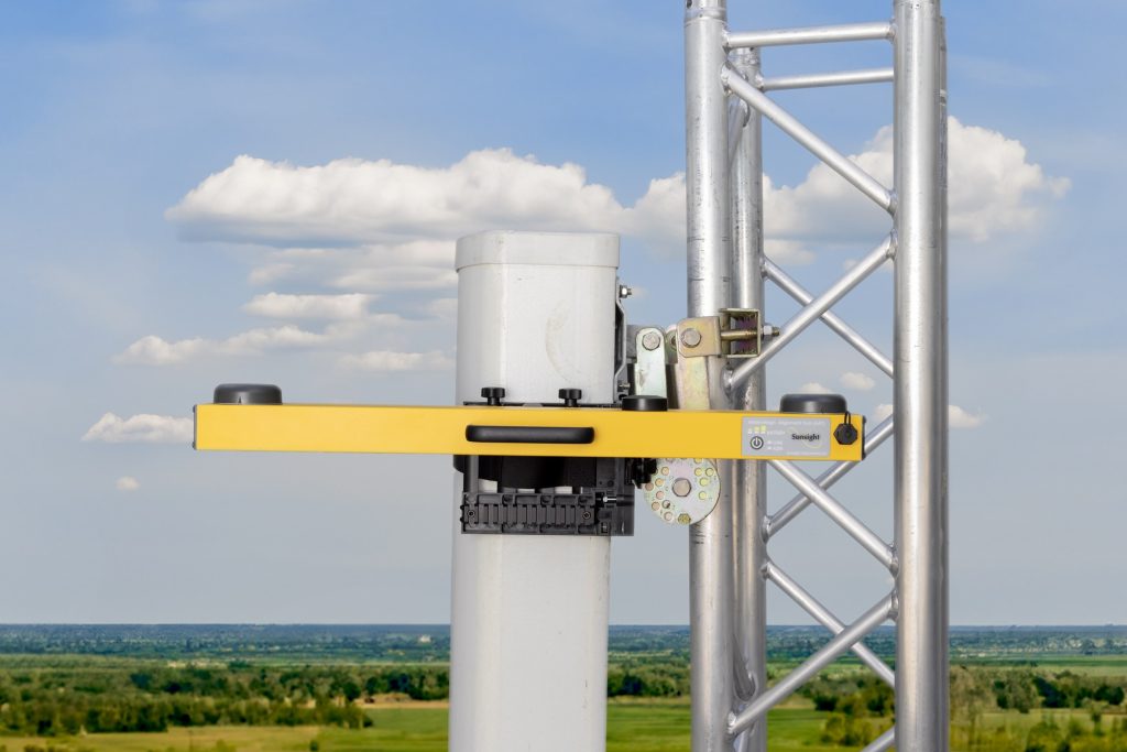
AAT Mini – Click for Product Details
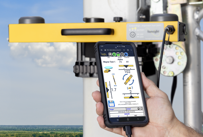
AAT Max (highest accuracy) – Click for Product Details