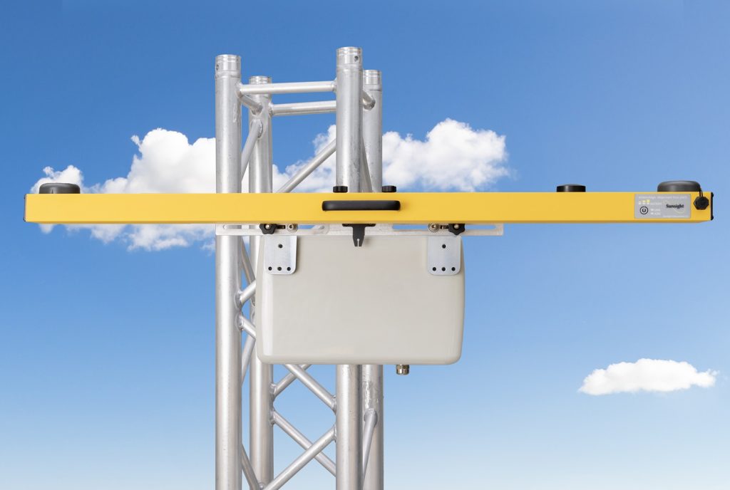
There is no product in the same class as the Sunsight AntennAlign® Alignment Tool (AAT) Max for delivering accurate field measurements. With an accuracy of .08 degrees RMS in azimuth and .1 degree in Tilt and Roll, the AAT Max is by far the highest precision alignment tool of its type. The standard AAT Max housing can accept custom mounts designed and built by Sunsight or customer supplied mounts that attach directly to the housing’s threaded inserts.
The Sunsight AAT Max is the toughest, most accurate antenna alignment tool for directional antenna (i.e., cellular panel) installation or antenna alignment audits. It measures antenna alignment in azimuth, tilt, and roll (plumb) while indicating its height above ground level (AGL) with the Laser Rangefinder Option. The AAT can be operated using any smartphone or tablet, including a free photo reporting feature for 5G Android smartphone or tablet users.
Sunsight alignment systems’ new user interface provides intuitive visualization and helpful indicators that guide the technician to reach their target alignment. Azimuth, Tilt, and Roll are displayed in icons and text. Views are customizable, allowing easier viewing on bright days when reading displays can be difficult. The technician chooses the layout that suits them best.
The Sunsight AAT uses an industry-leading set of GNSS constellations, including GPS, GLONASS, Galileo, SBAS, and Beidou. Using these multiple systems provides the quickest and most accurate measurements in the industry. The most crucial advantage of multiple GNSS systems is the ability to get readings where other devices cannot. Issues related to obstructions, such as foliage, etc., are highly minimized compared to using GPS and GLONASS only.
All this while still maintaining the durability and ruggedness that Sunsight users have come to expect from the most fully featured device in the industry.
The latest additions to the AntennAlign Alignment Tool ™ (AAT) Max include the following:
- An added USB-C Cable interface which allows the AAT to be used in the harshest interference environments.*
- Adoption of latest multi-constellation GNSS positioning system (5 constellations) which improves azimuth acquistion under poor conditions.
- A new, easy-to-use icon-based interface which minimizes learning curves and language barriers while providing fewer keystrokes and a more flexible user experience.
- An updated mounting system which supports a greater variety of antenna sizes and shapes.
Key features of Sunsight AATs include:
- Sunsight is the only brand accepted by all carriers in all markets in the U.S.
- Highest Measurement Performance: produces by far the most accurate alignment measurements of any antenna alignment tool in the industry for azimuth, tilt and roll, and MSL height. AGL height add-on is available.
- The AntennaView Camera Mounting System for smartphones* creates the same horizon view as antenna boresight to identify potential line-of-sight interference quickly. It negates the need for an expensive, fragile embedded camera (up to $1000 savings over other alignment tools). Add an additional picture to show the AAT mounted on the antenna, as required in many closeout reports. An industry first!
- Create Google Earth (patent-pending) Virtual Reality Interference Reports (VRIR) for your customers, allowing them to view potential interference and obstructions.
- Field Proven Toughness: IP-65 weather resistance (works in rain/snow and desert heat), powder-coated aluminum housing, billet aluminum mounting system, no internal moving parts, no built-in display or camera lens to break. No plastic housing to shatter. Sunsight durability reduces repairs and downtime.
- Extensive reporting capabilities are standard, including PDF, CSV, antenna line of site photos, and Google Earth files.*
- Best Cost of Ownership: most features for the lowest price.
- No required annual returns for calibration (the end user can calibrate in the field in under two minutes). A savings of up to $900 over competitors and no unnecessary downtime.
- Supports multiple coordinate systems for international use
- British National Grid
- French Lambert II
- Irish National Grid
- Dutch RD Coordinate System (Rijksdriehoekscoördinaten)
- 3-year manufacturer’s warranty! Best in the industry.
- Designed and manufactured in the USA by a small business.
* For AAT users with an Android 11.0 or greater device
| Azimuth (Heading) Accuracy (degrees) | +/- .08 RMS +/- .16 R95 +/- .25 R99 |
|---|---|
| Tilt and Roll Range and Accuracy (degrees) | +/- 22.5 range +/- .1 accuracy |
| AGL Height (ft) | +/- 1 standard
+/- .125 premium |
| Horizontal Accuracy (ft) | +/- 1** |
| Vertical Accuracy – MSL (ft) | +/- 3** |
| Size (in) | 43 x 3 x 2.6 |
| Weight (lb) | 5.7 |
** Depends on multipath environment, number of satellites in view, and satellite geometry. Requires SBAS corrections.
View Detailed Site Sample Report (with pictures)
View Single Antenna Sample Report (with pictures)
